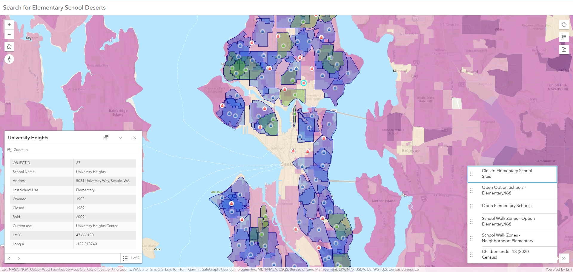
Seattle Public Schools - School Deserts
Historic sites of Seattle elementary schools overlayed with walk zones for current schools to identify school deserts caused by past school closures.
Hi, I'm Beth. I am a GIS Analyst and Wetland Biologist with experience in spatial analysis, wetland science, and environmental compliance. I am skilled in ESRI technologies and technical reporting for government and environmental clients. I am Adept at delivering clear, actionable geospatial insights and leading interdisciplinary projects from data collection to final reporting.
Services: spatial analysis, cartographic design, interactive dashboards, and data management.
Web maps, cartography & spatial analysis
Historic sites of Seattle elementary schools overlayed with walk zones for current schools to identify school deserts caused by past school closures.
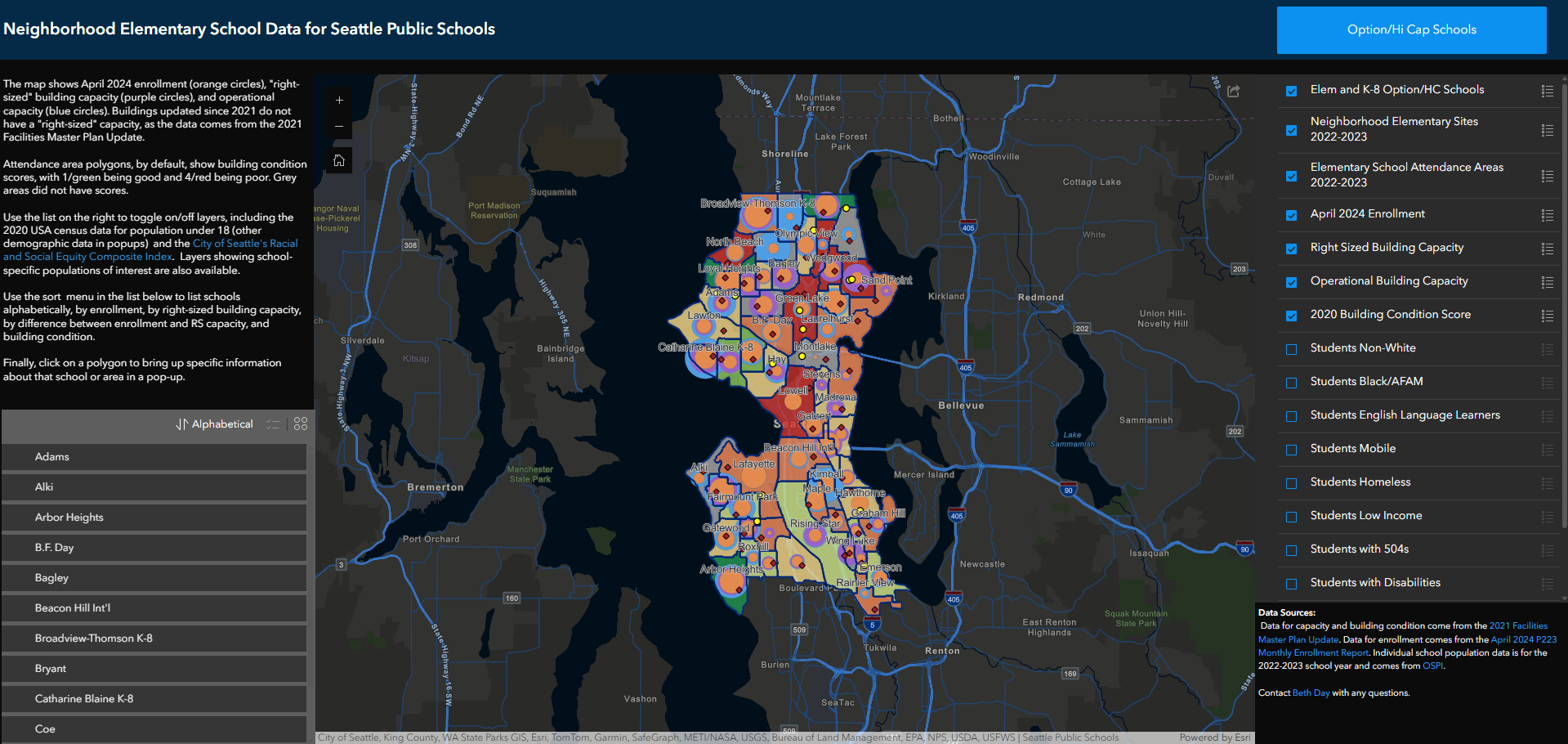
School by school enrollment, capacity, building condition and demographic data to help advocates make district-wide school comparisons.
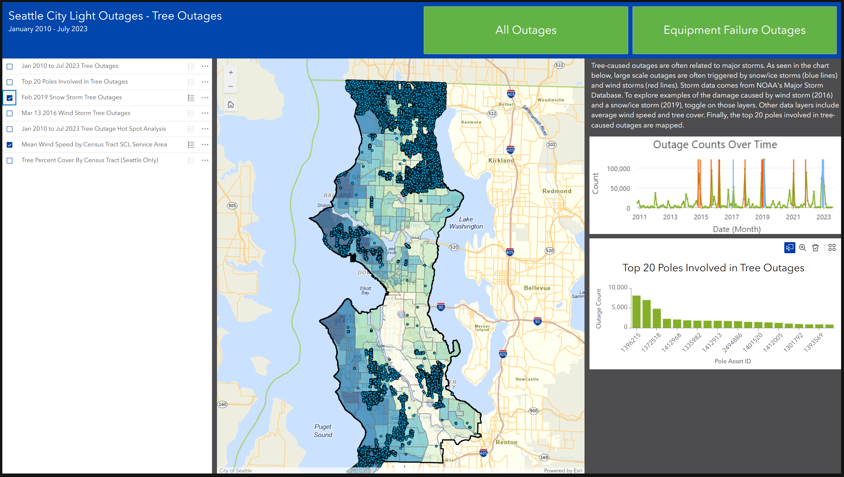
Analysis of complex dataset of historical power outages in City of Seattle, focusing on effects by trees/weather and equipment failures. Internal application.
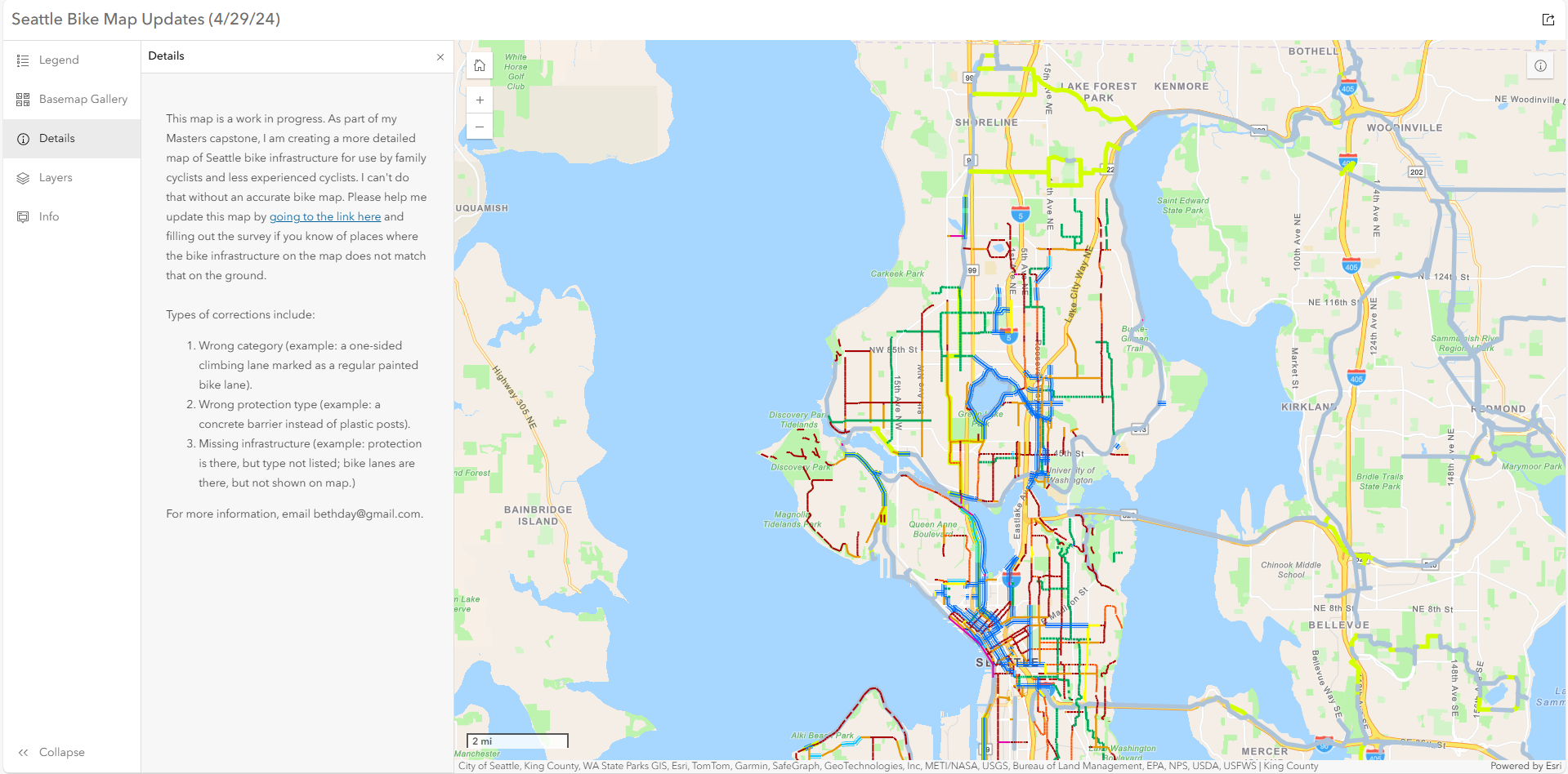
Creating a map enabling family cyclists and other safety-conscious cyclists to plan routes using safety and other Seattle transportation data.
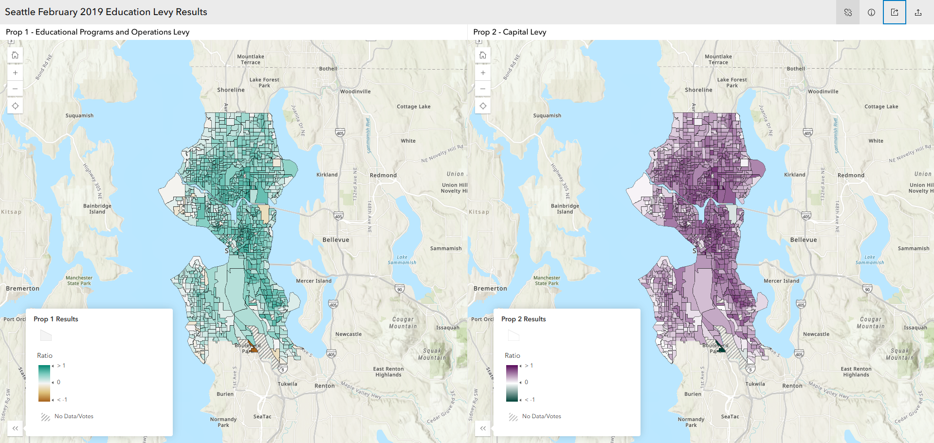
Map of Seattle education levy election results from raw King County Elections data.
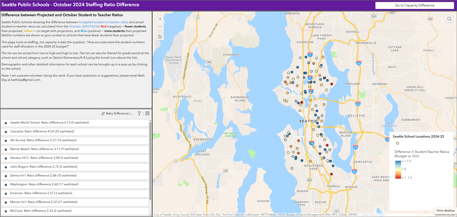
Seattle Public Schools comparison of actual fall enrollment versus budgeted and capacity by school.
Have a map in mind or need help with your spatial data? I’d love to chat.